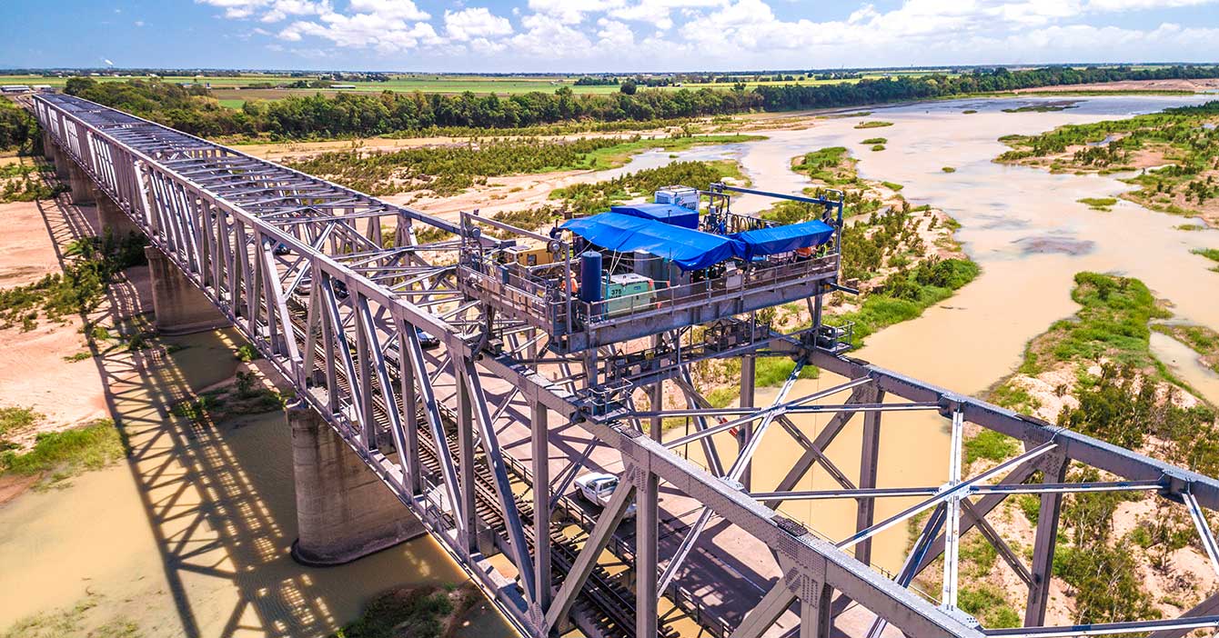
Burdekin River Bridge, rehabilitation program
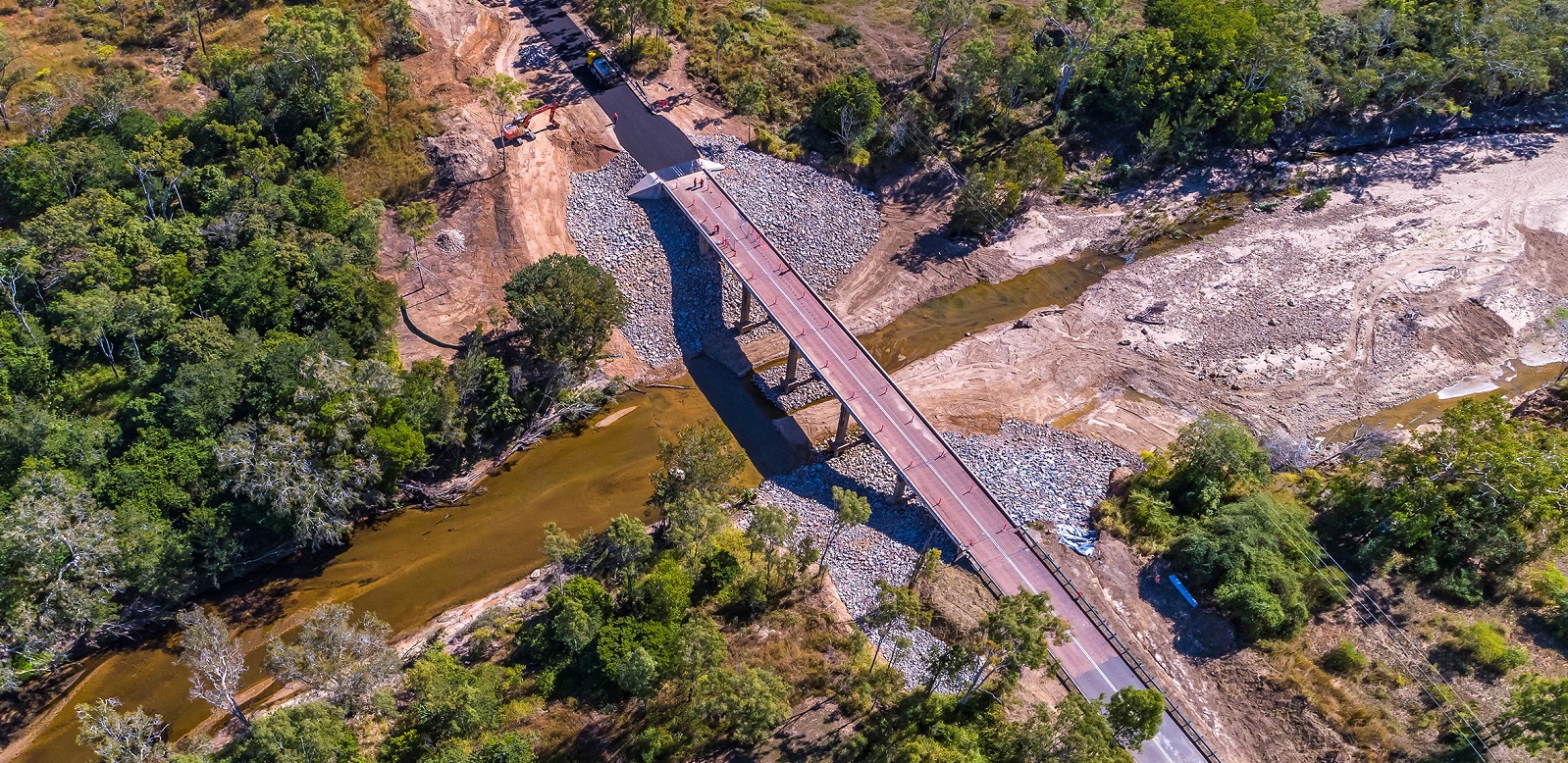
Rehabilitation and maintenance program to preserve the structural integrity of the Burdekin River Bridge. The ongoing program will ensure a safe and durable crossing is maintained for the long-term...
Rehabilitation and maintenance program to preserve the structural integrity of the Burdekin River Bridge. The ongoing program will ensure a safe and durable crossing is maintained for the long-term...
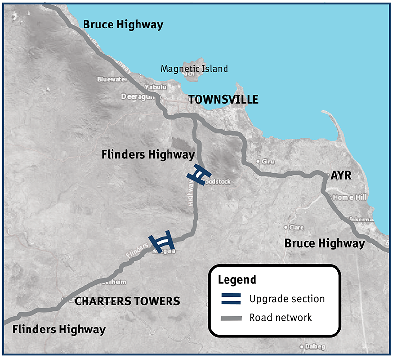
Three new overtaking opportunities on this key inland freight route to improve safety for motorists...
The Barron River bridge planning project will investigate long-term solutions for the bridge near Kuranda...
We are constructing a new recreational boat launching facility at Yorkeys Knob...

We are reconnecting communities and supporting regional economic recovery after disaster events damaged the state-controlled road network in 2020, 2021 and 2022...
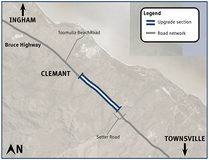
Bruce Highway (Townsville-Ingham) upgrade program...
Safety upgrades will be carried out at various locations along Douglas – Garbutt Road...
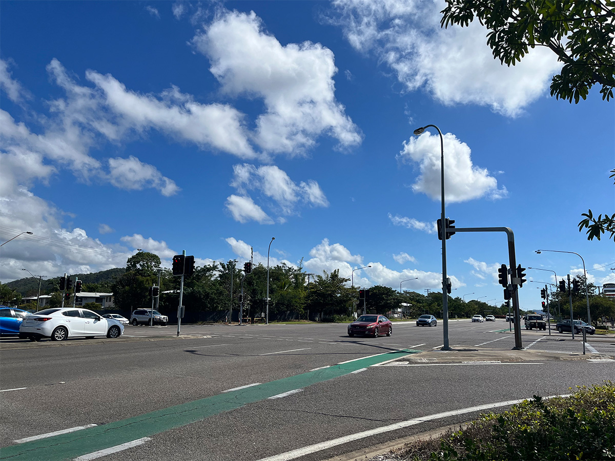
We are upgrading Townsville Connection Road to dual lanes between University Road and Bowen Road Bridge...
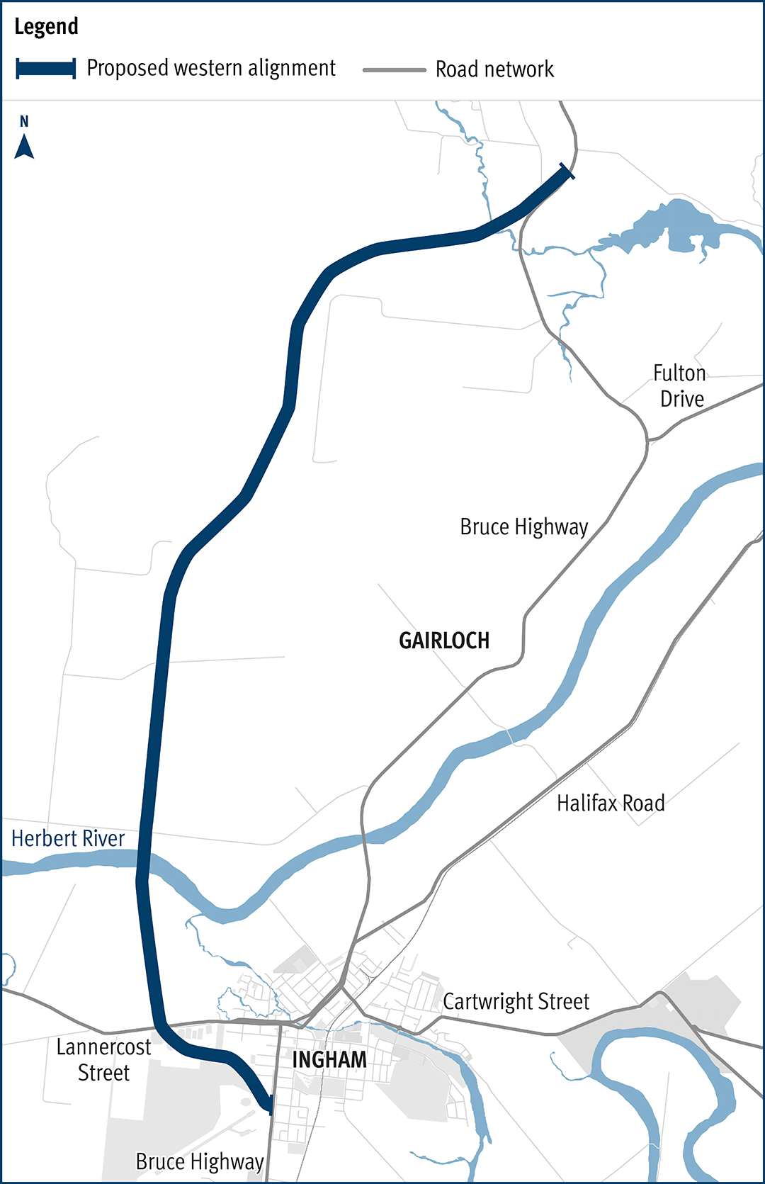
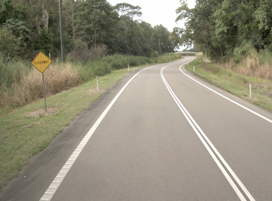
Planning has commenced to improve safety and reduce the time of closure due to flooding on a complex section of the Bruce Highway at the Gairloch floodway, 5km north of Ingham...
The department has been actively working with the community to address the challenges associated with the Bruce Highway from South of Ingham to the Cardwell Range...